By Nina Newington*
*First posted on Friends of Goldsmith Lake Wilderness Area on Jan 12, 2025
 I thought I’d expand on the zombie harvest plan news included in the Information Morning interview that aired on January 9th. The maps accompanying this post tell a lot of the story.
A little background for those of you who haven’t waded into the murky waters of public access to forestry information: since 2016, all new plans to log on Crown Land have been posted on the provincial Harvest Plan Map Viewer. (Searching HPMV NS should get you there.) When a new plan is posted, the public is given 30-40 days to comment. That’s our one and only opportunity to weigh in.

Archived harvest plans are outlined in olive. Note that there aren’t any on the peninsula (outlined in red.)
After that comment period is over, the plans remain on the HPMV as archived plans. The HPMV shows a number of these plans in the area proposed as the Goldsmith Lake Wilderness Area. Some have been executed, most have not, thanks to local people’s dedicated efforts to stop any further degradation of an area that should so obviously be protected.
The peninsula between Corbett and Dalhousie Lakes is in the easternmost part of the proposed Wilderness Area. The HPMV shows no archived plans to harvest there. But my most recent Freedom of Information request included a map of the peninsula with two harvest plans on it. Even more alarming was a reference to these as “priority blocks.”

This is DNR’s map showing the harvest plans for the peninsula. The darker grey circle just touching the northeast tip of Corbett Lake is the buffer zone around the Frosted Glass Whisker found last summer.
I wrote to Ryan McIntyre, DNR’s Resource Manager for the Western Region, asking for more information about these mystery plans. That was on December 19th. No word back so far.
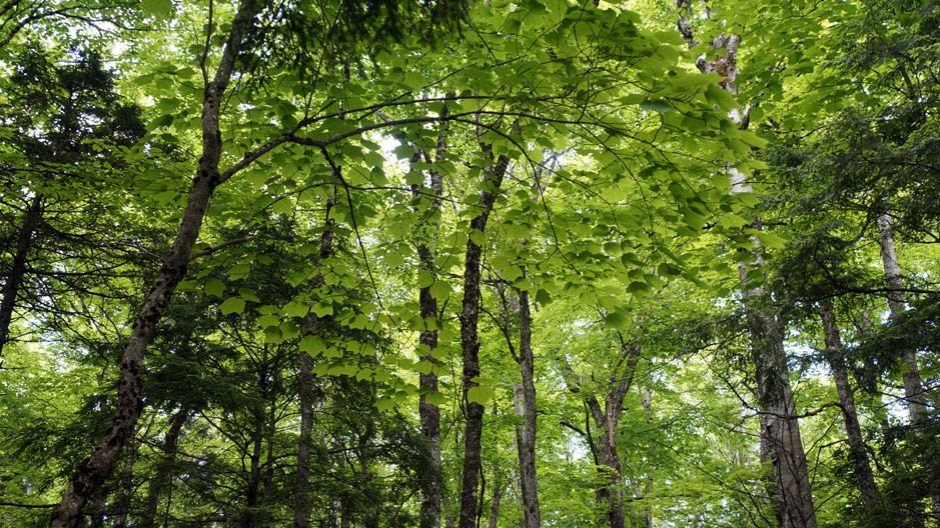
With a snow storm in the forecast and Christmas coming up, citizen scientists set aside plans for baking cookies and last minute shopping and went into the woods instead. In the harvest plan areas we found old hardwood and mixed forest, some of it old growth, to judge by the size of the Yellow Birch and Maples; the pit and mound ripple in the ground; the fallen giants, hollow trunks rotting into the soil. We found perfect dens for otters, nesting sites for chimney swifts, an amazing variety of clubmosses, ironwood, and, yes, 8 more Frosted Glass Whiskers lichens. Which we duly reported to DNR.
Frosted Glass Whiskers to the rescue again.

So many big beautiful yellow birch in the northern half of AP068637
If it hadn’t been for a Frosted Glass Whiskers lichen found and reported this past summer in the north end of the peninsula, the logging plans might not have shown up in my Freedom of Information Request. You have to be quite specific about what you are looking for in these requests. I certainly didn’t have plan ID numbers for the zombie harvest plans to include in the list I submitted. But I did list Species at Risk lichens, including Frosted Glass Whiskers. That’s how come the Freedom of Information request included a map showing the buffer zone around a solitary Frosted Glass Whiskers lichen in a harvest plan we didn’t know existed.
Well, we did and we didn’t. We thought they were long dead, those logging plans There was a time when they showed up on the HPMV, but then they went away. Now it looks as if DNR is quietly trying to resurrect them.
Back in 2014, DNR had a plan to partially harvest the peninsula. The public, as required, was given an opportunity to comment. That was before the HPMV was created. The plan was posted on the DNR website of the day. That was the last time the public had any formal opportunity to comment on the plans.
 In late 2018, harvest plans for the peninsula briefly showed up on the HPMV but they were promptly removed. Posting them had been a mistake, according to DNR. Fortunately, local naturalist Bev Wigney had spotted them. She organized a hike on the peninsula on Boxing Day. Word spread about the beauty of the old forest and the importance of protecting it.
In June 2019, local resident Debbie Stultz-Giffin spotted WestFor signs warning that the peninsula was about to become an industrial site. Logging, in other words, was imminent. Fifty people gathered in protest. By the end of that day, under the banner of Extinction Rebellion, a camp had been set up at the head of the logging road.
 There’s more to tell about that protest — it was my first time camping on a logging road – but that’s for another post. Suffice to say that, in the space of a week and after a particularly disastrous interview given by Marcus Zwicker, then general manager of WestFor, on Information Morning, logging plans were put on hold. That was over five years ago.
In the more than ten years since the public last had an opportunity to comment on harvest plans for the peninsula, the Lahey Report came out; the Kunming-Montreal Global Biodiversity Framework was signed by 196 countries, establishing the goal of protecting 30% of the Earth by 2030; the current government put the commitment to protect 20% of our province by 2030 into law. Things have changed, in other words. DNR even claims to be prioritizing biodiversity on 90% of Crown land.

The ones with the little crosses are the ones we found after discovering that this area may still be threatened with logging. Seven out of the eight have now been confirmed as the protected Frosted Glads Whiskers. The 8th needs a closer look. It might be the even rarer but so far unprotected Sclerophora amabilis.
They should not then be trying to enable the forestry industry to grab what it can while it still can from areas that have been proposed for protection. Trying to do it on the quiet, using plans that are so long past their sell by date they smell of the grave, let’s just say this is not a fitting way for a government department to behave.
And of course citizens should not have to file Freedom of Information requests to discover information that is supposed to be available to the public on provincial maps.
The secrecy smells as bad as the zombie harvest plans.