UPDATES: View
– Conservation groups say Nova Scotia falling short of 2030 goal to protect land CTV News Report/Video (June 10)
– Coalition of 55 groups demands Houston government act on protecting natural areas in Nova Scotia
Suzanne Rent in Hfx Examiner, intro in Morning File (Jun 11)
– Conservation groups urge province to accelerate protection of Nova Scotia lands
Post on Forest Forever, n.d.
—————-
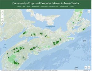
New online map shows Community-Proposed Protected Areas in Nova Scotia. The map, created by GIS mapping expert Shanni Bale, was produced as a joint project of the Ecology Action Centre (EAC) and the Healthy Forest Coalition (HFC) – see About the Project
From a Press Release by the Ecology Action Centre today (June 10, 2026):
Over 50 groups from across the province came together in Halifax today to send a united message: the Nova Scotia government needs to accelerate its efforts and collaborate with the public in order to meet its protected areas commitments to protect 20 per cent of the province by 2030… at the current rate, it would take the Province until 2041—11 years after its legislated deadline.
At the press conference, the Ecology Action Centre and the Healthy Forest Coalition unveiled a new online map showing more than 30 sites of high conservation value.
These are sites on public lands that groups across the province have identified and nominated to the government for assessment and potential protection.
Together, these sites would protect approximately 127,864 hectares (1278.64 square kms) of Nova Scotia’s natural heritage. They would also contribute 2.3 per cent towards the legislated 20 per cent target.
———
COMMENT (NSFM)
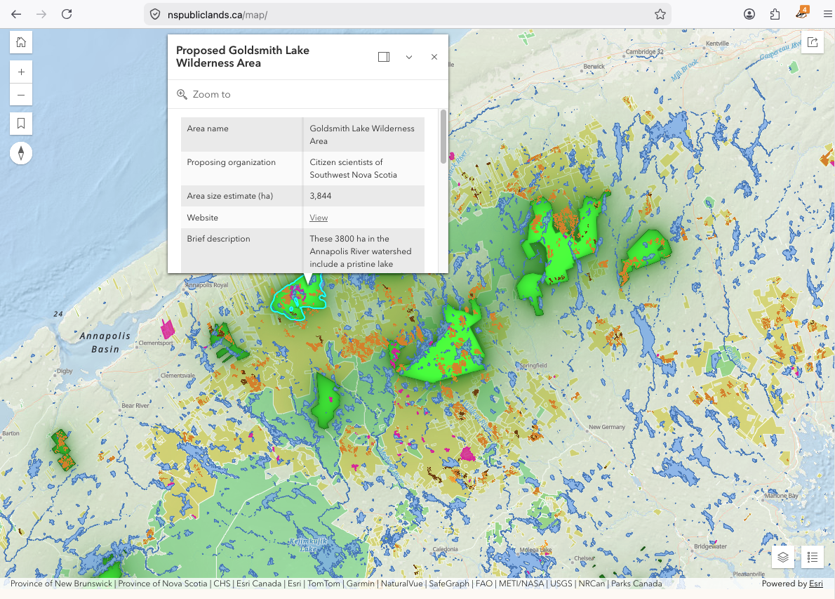
A portion of the map with all layers turned on (NSFM screencapture)
As well as current Community-Proposed Protected Areas highlighted in bright green, the map shows in other shades of green:
– Existing Protected Areas*
– Areas Open for Consultation*
– Pending Protected Areas*
Click on a polygon for any of the categories above and related info comes up.
In addition, under the Layers Menu one can bring up
– All of the “Public Lands” (Crown Lands)*
– Officially-recognized Old-growth forest*
– Water features (only at higher levels of zooming in)*
– Crown Land Harvest Plans (currently showing data downloaded Jan 29, 2026)*
*It is noted that the map “includes data by the Department of Service Nova Scotia (SNS). The incorporation of data sourced from the Department of Service Nova Scotia within this map shall not be construed as constituting an endorsement by the Department of Service Nova Scotia of our map. Data obtained from SNS is reproduced and distributed with the permission of the Department of Service Nova Scotia.”
It’s an an incredibly useful resource and even a work of art. I am aware that it has been in the making for some time, certainly the wait has been worth it – Kudos to EAC, HFC and Shanni Bale!
Lets hope – let’s make sure – that it is well used and allows us all to participate in achieving the widely applauded goal of our government to protect 20% of NS by 2030.
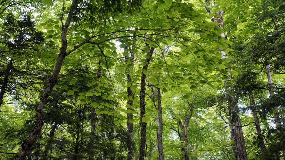
It is an exciting time in Nova Scotia. We are experiencing unprecedented growth, transforming how we produce and use energy, creating a clean economy, and more. As this growth and transformation continues, and as needs for homes, health-care facilities, public infrastructure, and other services increase, it is more important than ever to have more natural areas protected in perpetuity. Protecting more natural areas is one of the greatest gifts we can leave to future generations of Nova Scotians.
Government cannot achieve the 20 per cent protection goal on our own. It will take an all-hands- on-deck approach. Nova Scotia is fortunate to have strong conservation partners and we thank them for their conservation work.
- Tim Halman, Minister of Environment and Climate Change
- Tory Rushton, Minster of Natural Resources & Renewables
In the Collaborative Protected Areas Strategy: An Action Plan for Achieving 20 Per cent
NS Gov. Dec 2023,