By Nina Newington
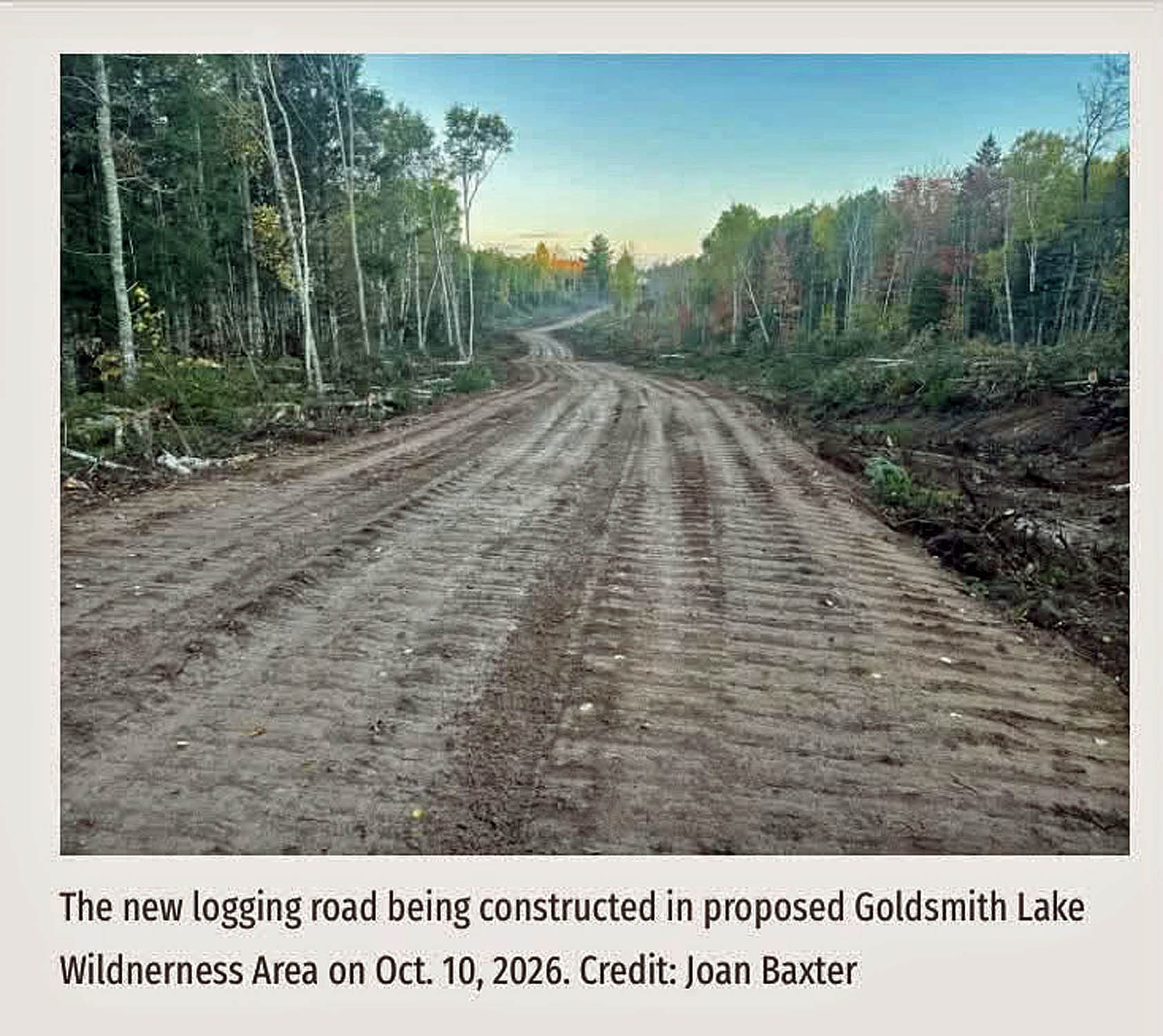 It’s all about the road.
WestFor, with DNR’s approval, is currently building a road through buffer zones supposed to protect endangered Black ash on Crown land in Annapolis County. Black ash is one of the species at risk covered by Nova Scotia’s Endangered Species Act. Black ash trees are exceedingly rare.
The road and the harvest area fall within the Goldsmith Lake Wilderness Area, an area twenty minutes south of Bridgetown proposed for permanent protection in 2022 by the Citizen Scientists of Southwest Nova Scotia. WestFor responded back then by claiming that the whole area had been clearcut in the 1970s and was not worth protecting. (WestFor is the consortium of mills created in 2016 by government and industry to manage the lands Nova Scotians bought back from the bankrupt Bowater Mersey Pulpmill.) DNR’s response was only slightly more measured.
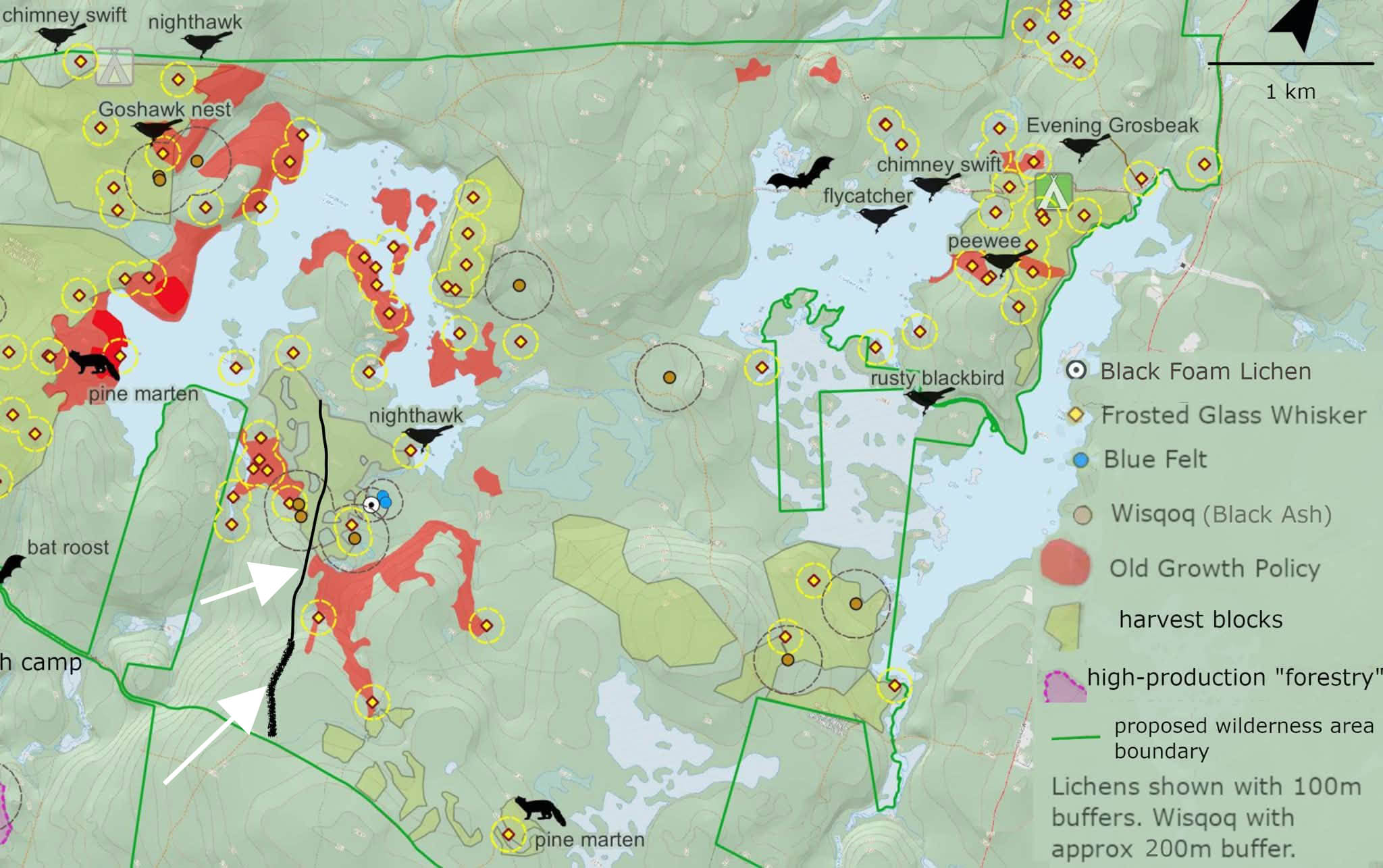
Map showing Road into Goldsmith Lake peninsula area. Fuzzy black line is existing road. Thinner black line is road currently being built.
Since then, the citizen scientists have identified and reported 138 species at risk occurrences within the proposed wilderness area. Thirty-one stands of old growth forest have been formally recognized.
There is very strong support within Annapolis County for protecting this area, from community members, businesses and local government.
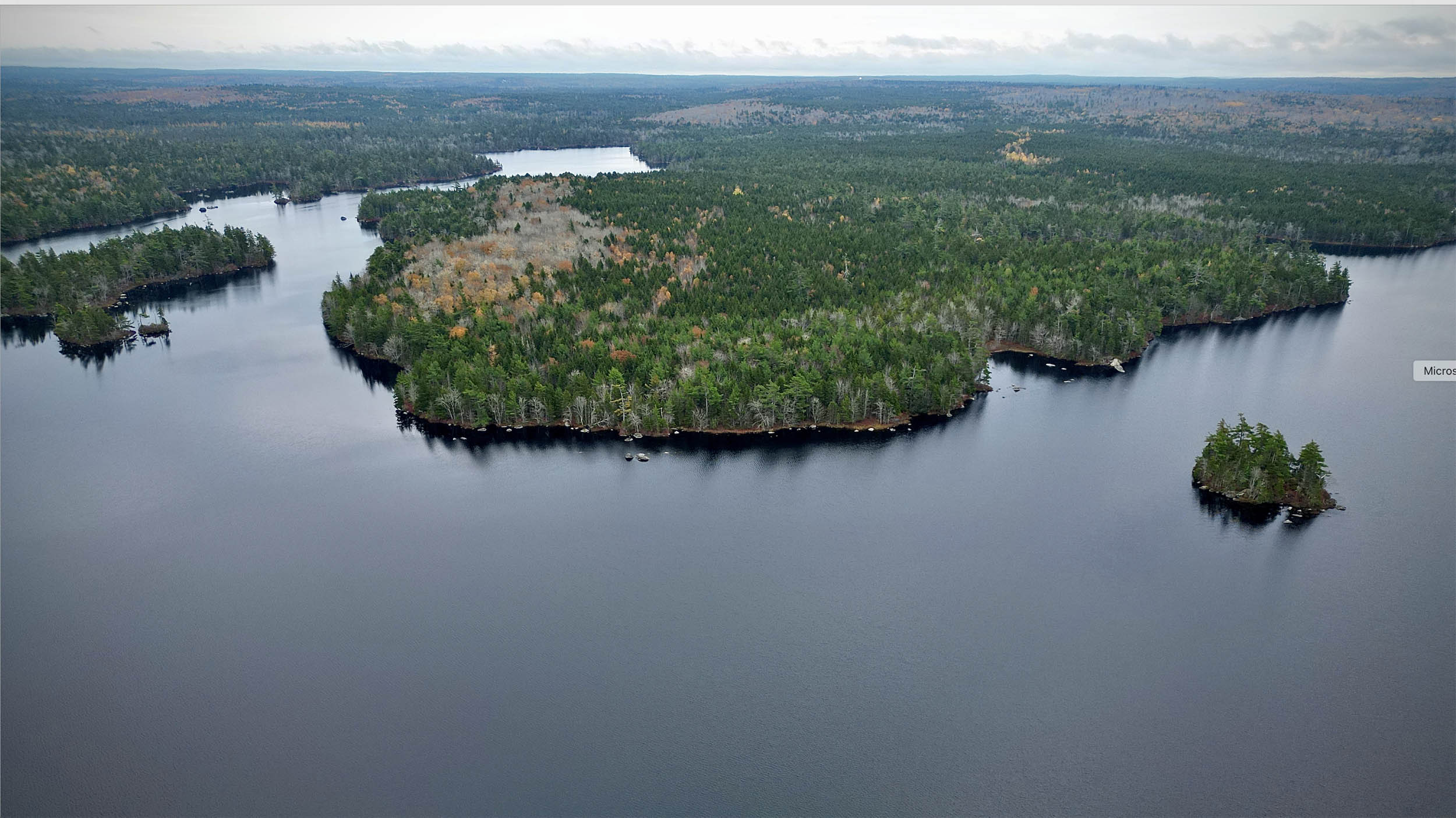
Goldsmith peninsula in October 2023. Photo by Richard Bennett
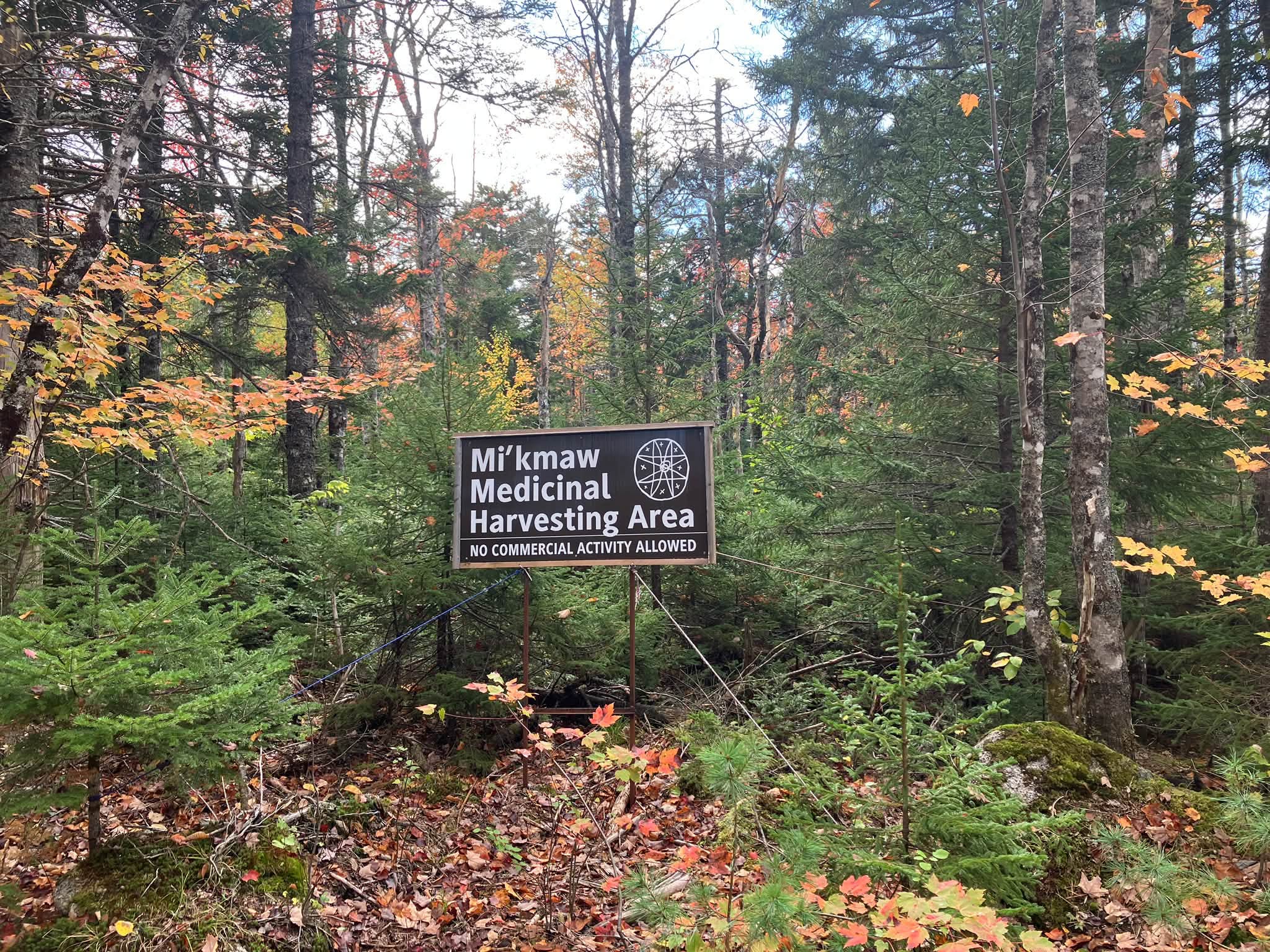
In 2025, the Peace and Friendship Medicine Trail, a Mi’kmaw-led partnership between L’nu and settlers, identified areas in the proposed Goldsmith Lake Wilderness Area for medicinal plant harvesting. A Peace and Friendship Medicine Trail public event happened in the area this past August.
In late September, when road building activities were discovered in the Mi’kmaq Medicinal Harvesting area south of Goldsmith Lake, Mi’kmaw Matriarchs with the Peace and Friendship Medicine Trail were notified. Notice of Traditional and Continuous Use was posted on September 30 close to where the road building equipment was parked. Settlers who have been partnering with the Peace and Friendship Medicine Trail and working to protect the Goldsmith Lake area set up camp to monitor whether this Mi’kmaq assertion of Treaty Rights would be respected.
 |
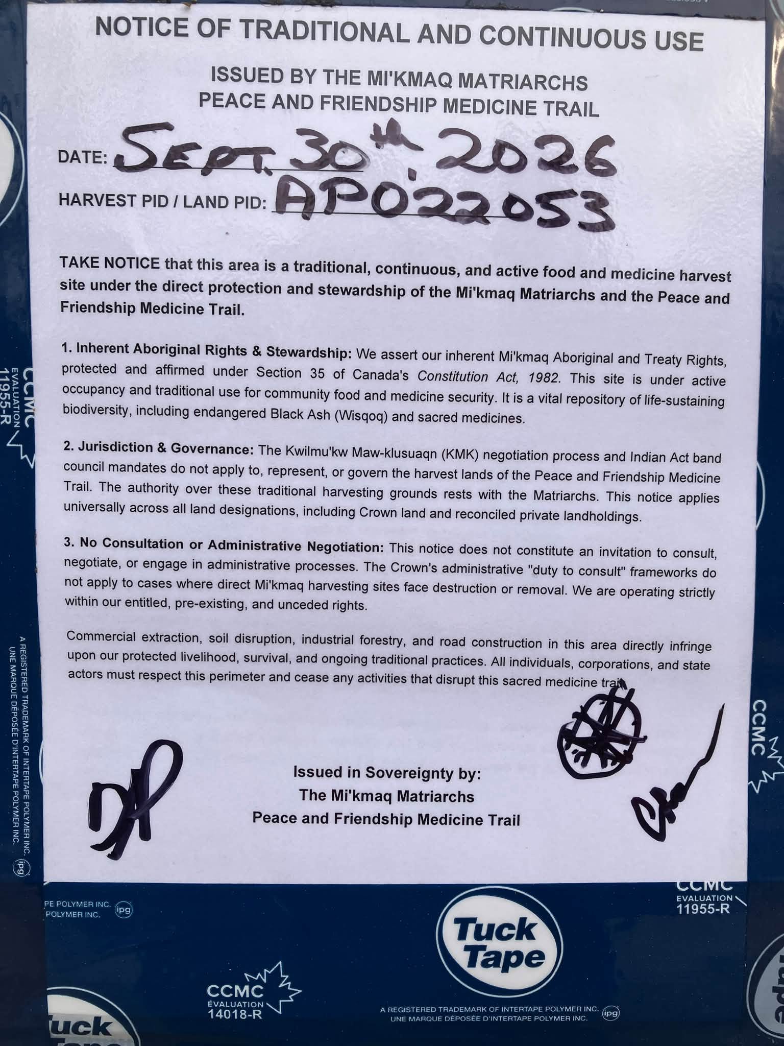 Notice posted Sep 30, 2027 |
When the notice was ignored, local Mi’kmaq tied a copy of the notice to the door handle of the excavator. After this too was ignored, Mi’kmaw Matriarchs with the Peace and Friendship Medicine Trail came and served notice in person to the equipment operator. He stopped work and moved his equipment back to where he had begun building the road. That was on Friday, October 9.
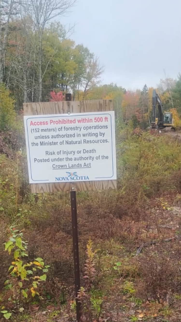 On Wednesday, October 14, work began again on the road. That afternoon, Conservation Officers with DNR came to the site and ordered the camp removed, citing safety regulations. The campers, after consulting with Peace and Friendship Medicine Trail leadership, complied with DNR’s order.
A road to where?
Clearly, this particular road is important to WestFor and DNR. They are willing to breach protective buffers required under Nova Scotia law, and to ignore Indigenous assertions of Treaty Rights on unceded Crown land in order to build it.
The road being put in through the Black ash buffers is nominally being built to access a 24-hectare High Retention cut (AP022053), meaning no more than a third of the trees will be removed. Not counting the trees clearcut for the roadway. The roadway, from the end of the existing logging road all the way to the northern boundary of the harvest plan area, is a clearcut strip 20m wide by a little over 1km long. It briefly narrows to 10m through the 200m Black ash buffer zone. The road itself is quite massive, 6-7m wide, often with deep ditches to either side.

Yellow birch, 107 cm diameter at breast height. in a stand by Goldsmith Lake identified by citizen scientists in 2023 as possible Old Growth. The stand was subsequently investigated by DNR revealing hardwoods over 200 years old
Roads like this one aren’t cheap, ecologically or economically. Along with forest degradation, habitat fragmentation is the primary cause of biodiversity loss in Nova Scotia. Wildlife such as the endangered Mainland moose, needs large, continuous areas of forest and wetland. Our forests are getting younger, simpler, poorer, and they are being chopped into smaller and smaller pieces by the logging roads that are built to get the wood out. New logging roads are scaled to giant clearcutting equipment, even when they are supposedly creating access for the new ‘light touch’ ecological forestry.
DNR’s harvest approval describes the road as a rebuild. As one of the citizen scientists who hiked into the area in November 2024, after DNR posted the plan for public comment to the Harvest Plan Map Viewer, I can say with certainty that there was only the trace of an old, grown-in logging road for the first 400m, up to the edge of the Black ash buffer. Beyond that, whatever road may have existed 50 plus years ago had disappeared for all intents and purposes.
They just didn’t build roads back then the way they do today. This new road will still be a scar on the landscape a hundred years from now. It passes close to stands of old growth forest to either side. The habitat for lichens along the south boundary of the harvest area is the richest and most diverse we have found to date in the Goldsmith Lake Wilderness Area. Clearcutting a roadway 20m wide into such an area changes the shady, humid interior forest conditions that allow such a variety of lichen life to thrive.
 Wind is a powerful force in Nova Scotia’s forests. Coupled with the other impacts of climate change, and on top of continued industrial forestry, the stresses are multiplying. Protecting rich, biodiverse habitat is more important than ever. That means rethinking where and how roads are built.
But that’s not what’s happening. Here’s what WestFor has to say about building this particular road:
‘WestFor has hired a local reputable independent business to conduct much needed maintenance of an old existing forest access road. We are proud to be able to provide this work to Nova Scotians to improve our forest and communities for better forest management, public access and emergency access allowing many Nova Scotians to enjoy the forest.’
This is the first paragraph of the statement issued on October 13 in (non-)response to questions journalist Joan Baxter asked WestFor about the roadbuilding.
The road now being built is a dead-end road into a peninsula surrounded by water. There are no communities nearby. No need for emergency access, in other words. Whatever lipstick WestFor wants to put on this particular pig, the function of this massive road is to allow logging access. Given the cost of roadbuilding, it is perhaps understandable that they aren’t claiming any economic benefit from this road. They are unlikely to get enough stumpage to cover the cost of the road from whatever company they contract to cut a third of a 24 hectare stand.
So why are they insisting on building this road?
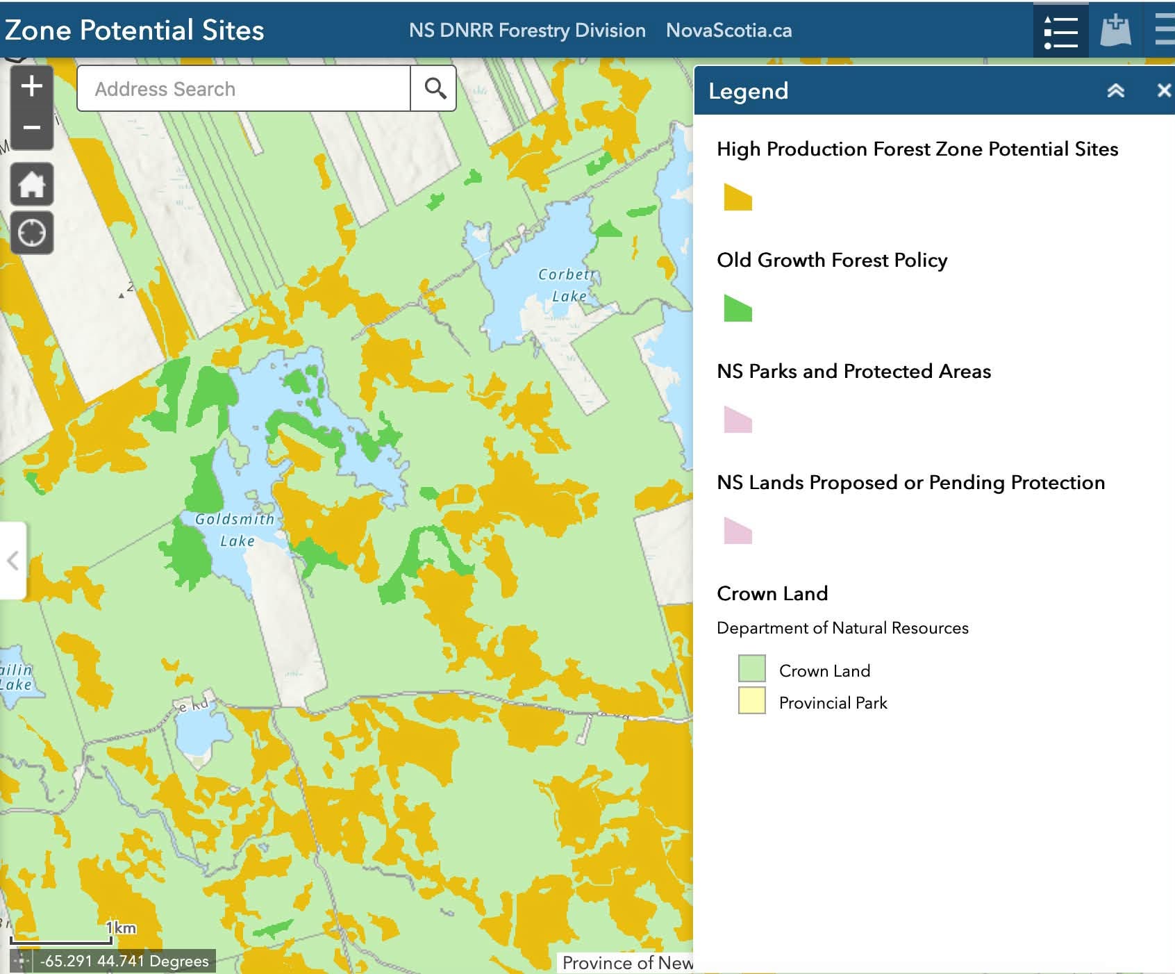
Extract from NS Gov map of potential sites for High Production Forestry
What WestFor doesn’t mention is that, having managed to put a road in this far, thanks to violating the Black ash buffers, they will, in future, be able to extend the road into the rest of the peninsula. DNR’s desktop analysis has identified the peninsula that separates the two arms of Goldsmith Lake as suitable for ‘High Production Forestry’, i.e. clearcutting and spraying. The road is the only way to access the peninsula by land. Without it there will be no way to turn a peninsula surrounded by the so-far pristine waters of Goldsmith Lake, with stands of old growth forest along the whole eastern shore of the peninsula, into an industrial tree farm.
This grim vision of DNR’s ecocidal intent is speculation on my part. But I do know from multiple freedom of information requests, that, once a road is built, the fact that money was spent building it becomes an argument for logging all the areas it gives access to.
It is also becoming clear that, for whatever reasons, this government has decided that,
– no matter the documented ecological value of certain areas of crown land,
– no matter the community support for protecting them,
– no matter the government’s legislated commitment to protecting 20% of our lands and waters,
they simply will not allow those areas to be protected.
The other function of the road, then, is to degrade the ecological value of the area. To make it less worth protecting. This cynical approach to ‘managing’ our public lands is, I fear, on display in the proposed Ingram River Wilderness Area as well as Goldsmith Lake.
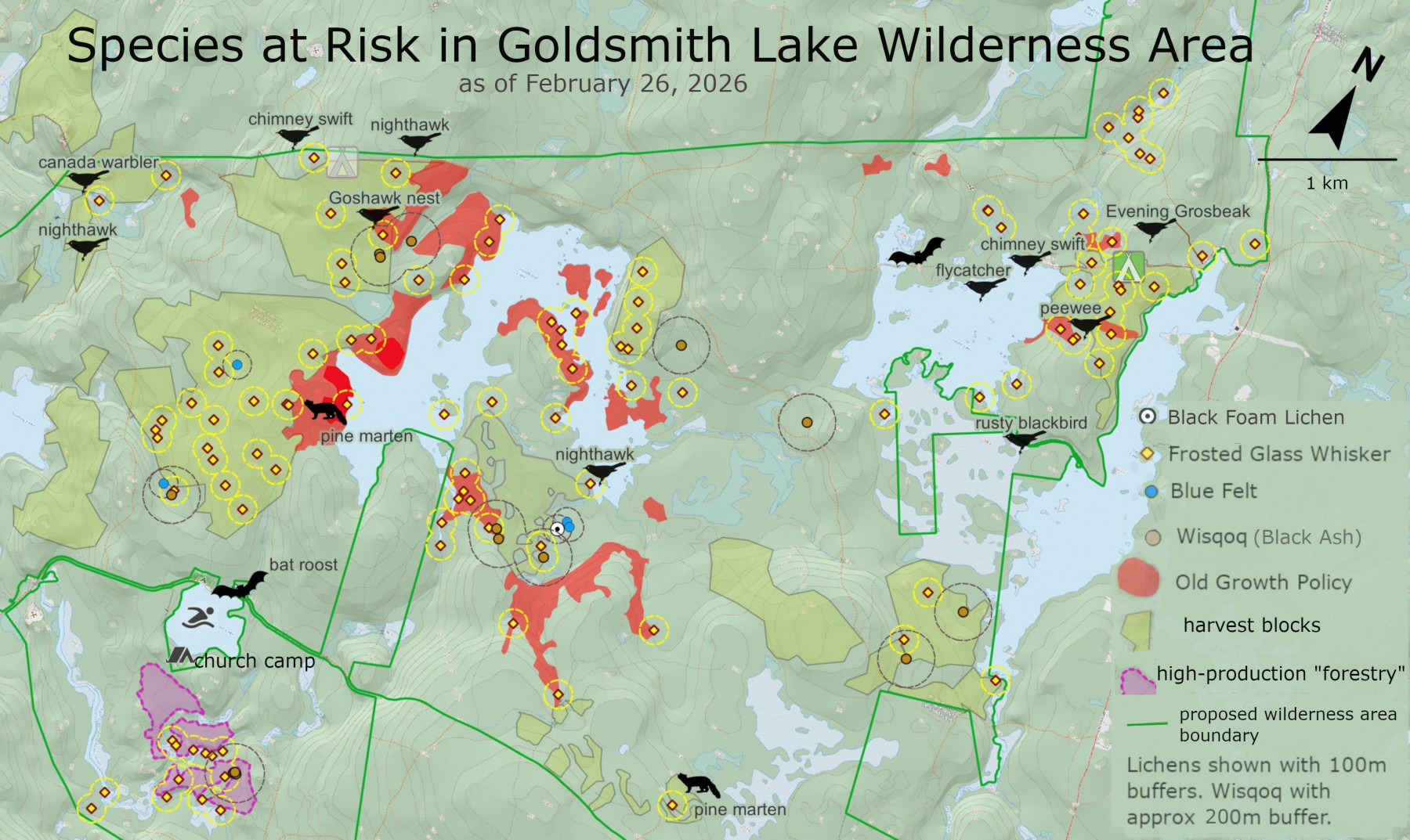
Species at Risk in the GLWA. In addition to the SAR that have been documented and confirmed, Pine or American Marten (Martes americana) have been observed and reported at multiple locations in the proposed Goldsmith Lake Wilderness Area. The American Marten is listed as a Species at Risk in Cape Breton and is in the process of being listed as endangered in the whole province.
This leaves one last question about the road.
Who is paying to build it? DNR is known, even within government, as a black box. Road funding seems to be a box within the box.
Funding is a question for another day. Reliable information would be most welcome.
RELATED
– CAMP NOW Page on this website.
Copies of original posts by Nina Newington and others related to Camp Now on Friends of Goldsmith Lake Wilderness Area (a Public Facebook Group) are compiled in the CAMP NOW page on this website.
– Map of “Community-Proposed Protected Areas” in Nova Scotia released by EAC/HFC
Post on NSFM, June 10, 2026.
– Save Our Old Forests
Environmental Conservation Organization · Nonprofit organization (Nova Scotia)
Website at http://www.saveouroldforests.ca/